


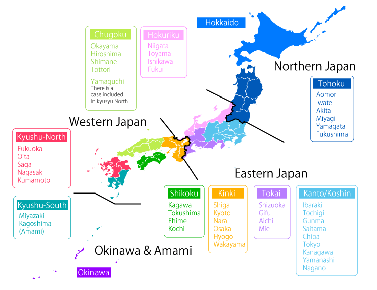
Japan has four distinct seasons with a climate ranging from subarctic in the north to subtropical in the south.
Conditions are different between the Pacific side and the Sea of Japan side.
Northern Japan has warm summers and very cold winters with heavy snow on the Sea of Japan side and in mountainous areas.
Eastern Japan has hot and humid summers and cold winters with very heavy snow on the Sea of Japan side and in mountainous areas.
Western Japan has very hot and humid summers (with temperatures sometimes reaching 35 C or above) and moderate cold winters.
Okinawa and Amami have a subtropical oceanic climate.
These areas have hot and humid summers (with temperatures rarely reaching 35 C or above) and mild winters.
Winter (December-January-February)
In winter (December-January-February), the Siberian High develops over the Eurasian Continent and the Aleutian Low develops over the northern North Pacific.
Prevailing northwesterly winds cause the advection of cold air from Siberia to Japan and bring heavy snowfall to Japan's Sea of Japan side (upstream of mountainous land) and sunny weather to its Pacific side (downstream of mountainous land).
Temperatures as low as -20°C are frequently observed in inland areas of Hokkaido, while Okinawa and Amami have mild winters due to their subtropical location.
Spring (March-April-May)
In spring (March-April-May), migratory cyclones and anticyclones that alternately move eastward prevail across Japan.
Temperature increases (decreases) in front (back) of cyclonic systems due to warm southerly (cold northerly) flow.
Temperature rises gradually with large short-term variations.
Sunshine duration is long in the second half of spring due to the predominance of anticyclonic systems.
The rainy season (known as the Baiu) begins in early May in Okinawa and in mid-May in Amami.
Baiu. Rainy season (May-June-July)
The Baiu is a cloudy and rainy period of early summer in Japan.
All areas except the country's northernmost island, Hokkaido, experience this rainy season, which lasts from early June to late July.
In Okinawa/Amami (the southernmost part of the Japanese Archipelago), the Baiu starts and ends about a month earlier than elsewhere.
The period of the Baiu is operationally identified by the Japan Meteorological Agency (JMA) for each year and for 12 areas.
JMA has been trying to identify a transition period of about five days for the start and end of the Baiu, although this is by nature a challenging task in some cases.
The climatological date (from the average of data covering the period 1981-2010) at the center of each transition period is shown in the table below.
The climatic date (average of 1981-2010) of the center of each transition period
| District | Climatological date of Baiu onset | Climatological date of Baiu withdrawal |
|---|---|---|
| Okinawa | around 9 May | around 23 June |
| Amami | around 11 May | around 29 June |
| Kyushu (South) | around 31 May | around 14 July |
| Kyushu (North) | around 5 June | around 19 July |
| Shikoku | around 5 June | around 18 July |
| Chugoku | around 7 June | around 21 July |
| Kinki | around 7 June | around 21 July |
| Tokai | around 8 June | around 21 July |
| Kanto/Koshin | around 8 June | around 21 July |
| Hokuriku | around 12 June | around 24 July |
| Tohoku (South) | around 12 June | around 25 July |
| Tohoku (North) | around 14 June | around 28 July |
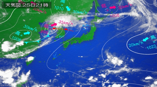
Summer (June-July-August)
Early summer is the rainy season, known as the Baiu, in Japan.
Its precipitation is caused by a stationary front, called the Baiu front, which forms where a warm maritime tropical air mass meets a cool polar maritime air mass.
In the second half of summer, the North Pacific High extends northwestward around Japan, bringing hot and sunny conditions to the country.
Western Japan sometimes experiences temperatures of 35°C or above.
On the other hand, the Okhotsk High sometimes appears over the Sea of Okhotsk and causes cool and moist easterly winds (known as Yamase), which bring cloudy and rainy conditions to the Pacific side of northern and eastern Japan.
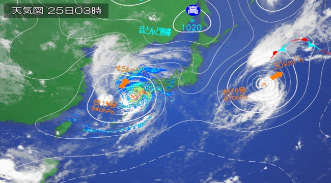
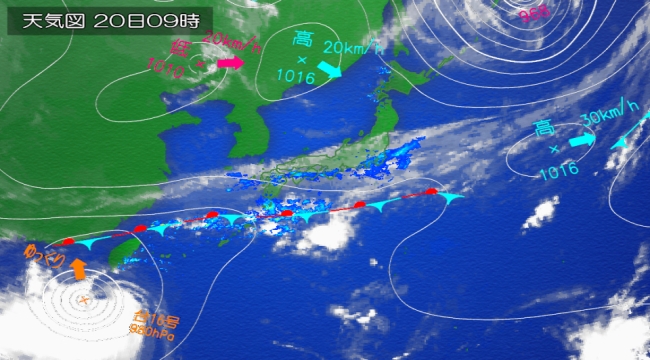
The number of tropical cyclones approaching Okinawa/Amami peaks in August.
Its precipitation is caused by a stationary front, called the Baiu front, which forms where a warm maritime tropical air mass meets a cool polar maritime air mass.
In the second half of summer, the North Pacific High extends northwestward around Japan, bringing hot and sunny conditions to the country.
Western Japan sometimes experiences temperatures of 35°C or above.
On the other hand, the Okhotsk High sometimes appears over the Sea of Okhotsk and causes cool and moist easterly winds (known as Yamase), which bring cloudy and rainy conditions to the Pacific side of northern and eastern Japan.
The number of tropical cyclones approaching Okinawa/Amami peaks in August.
Typhoon season (August-September)
Normal statistics for tropical cyclones with maximum wind speeds of 17.2 m/s or higher forming over the western North Pacific
Normal statistics are 1981-2010 averages.
Blanks in the tables indicate an absence of tropical cyclones for the month in question during the period 1981-2010.
The annual number of tropical cyclones approaching Japan does not always match the sum of monthly numbers because some approaches span two consecutive months.
Table 1 Numbers of tropical cyclones with maximum wind speeds of 17.2 m/s or higher forming over the western North Pacific, those approaching Japan, and those making landfall in Japan
| Jan. | Feb. | Mar. | Apr. | May | Jun. | Jul. | Aug. | Sep. | Oct. | Nov. | Dec. | Annual | |
|---|---|---|---|---|---|---|---|---|---|---|---|---|---|
| Formation | 0.3 | 0.1 | 0.3 | 0.6 | 1.1 | 1.7 | 3.6 | 5.9 | 4.8 | 3.6 | 2.3 | 1.2 | 25.6 |
| Approach | 0.2 | 0.6 | 0.8 | 2.1 | 3.4 | 2.9 | 1.5 | 0.6 | 0.1 | 11.4 | |||
| Landfall | 0.0 | 0.2 | 0.5 | 0.9 | 0.8 | 0.2 | 0.0 | 2.7 |
Table 2 Numbers of tropical cyclones with maximum wind speeds of 17.2 m/s or higher approaching the mainland of Japan and Okinawa/Amami
| Jan. | Feb. | Mar. | Apr. | May | Jun. | Jul. | Aug. | Sep. | Oct. | Nov. | Dec. | Annual | |
|---|---|---|---|---|---|---|---|---|---|---|---|---|---|
| Mainland of Japan | 0.0 | 0.1 | 0.4 | 1.0 | 1.7 | 1.7 | 0.7 | 0.0 | 5.5 | ||||
| Okinawa/Amami | 0.0 | 0.4 | 0.6 | 1.5 | 2.3 | 1.7 | 1.0 | 0.3 | 0.1 | 7.6 |
Table 3 Numbers of tropical cyclones with maximum wind speeds of 17.2 m/s or higher approaching each district of Japan
| Jan. | Feb. | Mar. | Apr. | May | Jun. | Jul. | Aug. | Sep. | Oct. | Nov. | Dec. | Annual | ||
|---|---|---|---|---|---|---|---|---|---|---|---|---|---|---|
| Okinawa | 0.0 | 0.4 | 0.6 | 1.4 | 2.2 | 1.7 | 0.9 | 0.3 | 0.1 | 7.4 | ||||
| Kyushu (South) and Amami |
Amami | 0.0 | 0.1 | 0.3 | 0.8 | 1.0 | 1.1 | 0.6 | 0.0 | 3.8 | ||||
| Kyushu (South) | 0.0 | 0.0 | 0.4 | 0.7 | 0.9 | 1.0 | 0.4 | 0.0 | 3.3 | |||||
| Kyushu (North) | 0.0 | 0.0 | 0.3 | 0.8 | 1.0 | 1.0 | 0.3 | 3.2 | ||||||
| Shikoku | 0.0 | 0.3 | 0.6 | 1.0 | 0.9 | 0.3 | 0.0 | 3.1 | ||||||
| Chugoku | 0.0 | 0.3 | 0.5 | 0.8 | 0.9 | 0.2 | 0.0 | 2.6 | ||||||
| Kinki | 0.0 | 0.3 | 0.5 | 1.0 | 1.0 | 0.5 | 0.0 | 3.2 | ||||||
| Tokai | 0.0 | 0.2 | 0.5 | 1.0 | 1.0 | 0.5 | 0.0 | 3.3 | ||||||
| Hokuriku | 0.2 | 0.4 | 0.9 | 0.8 | 0.2 | 0.0 | 2.5 | |||||||
| Kanto/Koshin | Kanto and Koshin | 0.0 | 0.2 | 0.4 | 0.9 | 1.1 | 0.6 | 0.0 | 3.1 | |||||
| Izu Islands and Ogasawara Islands |
0.1 | 0.4 | 0.3 | 0.8 | 1.2 | 1.3 | 1.1 | 0.3 | 0.1 | 5.4 | ||||
| Tohoku | 0.0 | 0.1 | 0.3 | 0.8 | 0.9 | 0.4 | 2.6 | |||||||
| Hokkaido | 0.1 | 0.2 | 0.7 | 0.7 | 0.1 | 1.8 | ||||||||
Autumn (September-October-November)
In autumn (September-October-November), temperatures fall gradually.
Monthly precipitation amounts are large in September due to the active autumnal rain front and tropical cyclones.
In October, the frequent passage of anticyclonic systems brings sunny conditions and refreshing air to Japan.
The frequency of cold northwesterly flows across Japan and precipitation (rainfall or snowfall) on the Sea of Japan side of the country show an increasing tendency in November.
Source: Japan Meteorological Agency